

Orthoimagery, Elevation, and CAD-Ready Deliverables
Supportive data built for surveyors, engineers and contractors: Orthomosaics, DSM/DTM surfaces, Contours, point clouds, and CAD/GIS exports-ready to measure, plan, and design.
You’re not buying drone deliverables — you’re buying time back.
My job is to capture dense site data quickly and safely, so your crew can focus on control, boundary, and the high-value judgment work.
Where You Save Time
Fewer boots-on-ground hours on large sites (topo context, features, grading areas)
Faster mobilization (capture in one flight window vs extended field days)
Less return-tripping (dense imagery/point cloud reduces “we missed that” moments)
Drafting efficiency (your drafters get consistent, organized datasets)
How I Fit Into a PLS Workflow
RTK capture by default for consistent, real-world positioning.
If you need tighter verification I’m equipped with GNSS receivers to collect GCPs/check points and will incorporate them into processing and provide a checkpoint comparison summary if requested.
Legal-safe note:
Boundary determination and legal surveying services are performed and certified by a Maryland-licensed Professional Land Surveyor (PLS). My role is survey-support data capture and deliverable preparation under your workflow.
Risk You’re Mitigating
Traffic corridors / roadside work: reduce exposure time
Steep slopes, unstable ground, stockpiles: less time near hazards
Active construction sites: minimize interaction with equipment
Difficult access (mud, brush, fenced areas): capture without forcing entry
Value Added
Drafting-ready context (orthos + point cloud + surfaces)
Better planning before field crews return (targeted follow-ups)
Repeatable progress/as-built documentation (same deliverables each visit)
Cleaner communication with engineers/contractors (visuals everyone understands)
Survey-Support Data Capture
-
![]()
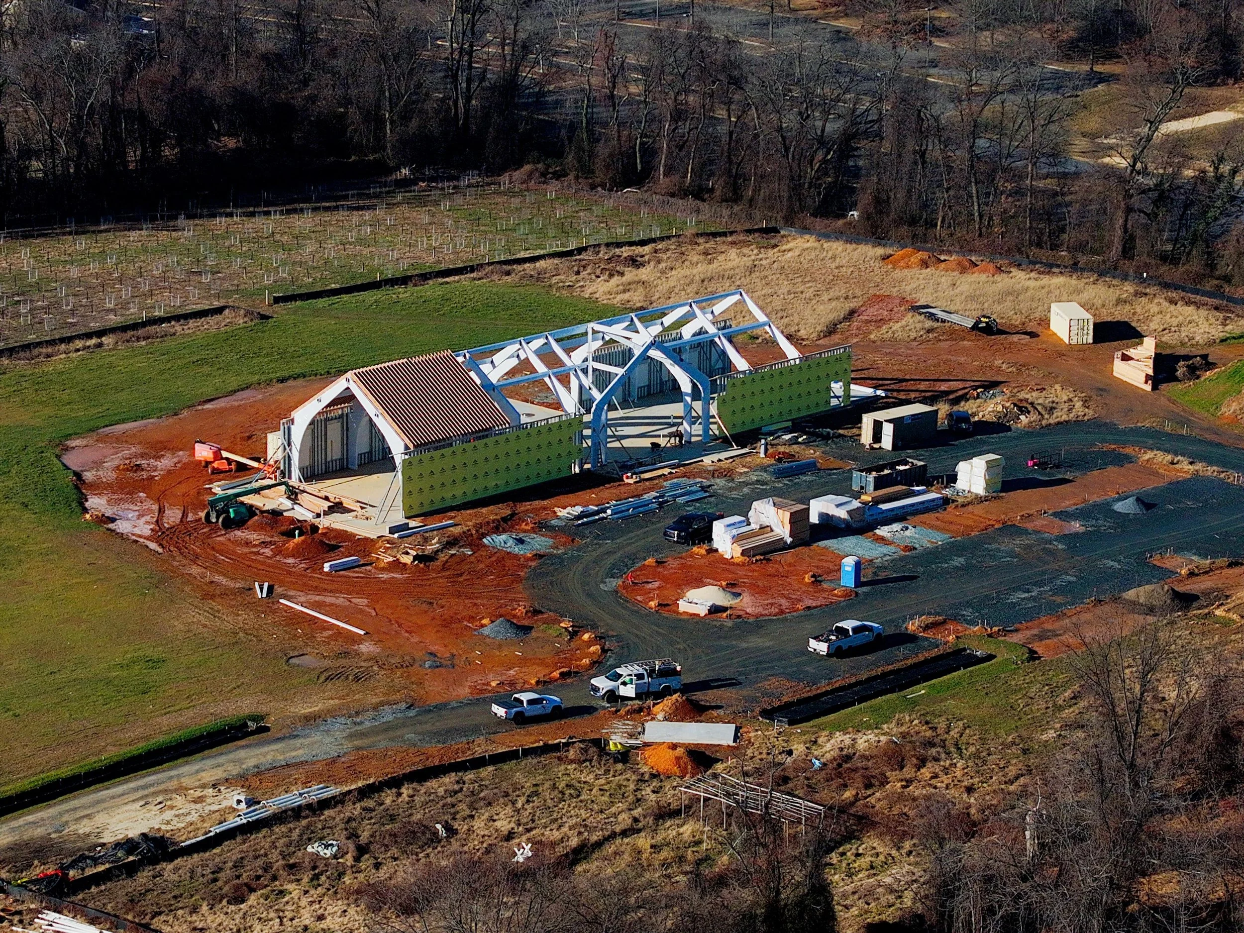
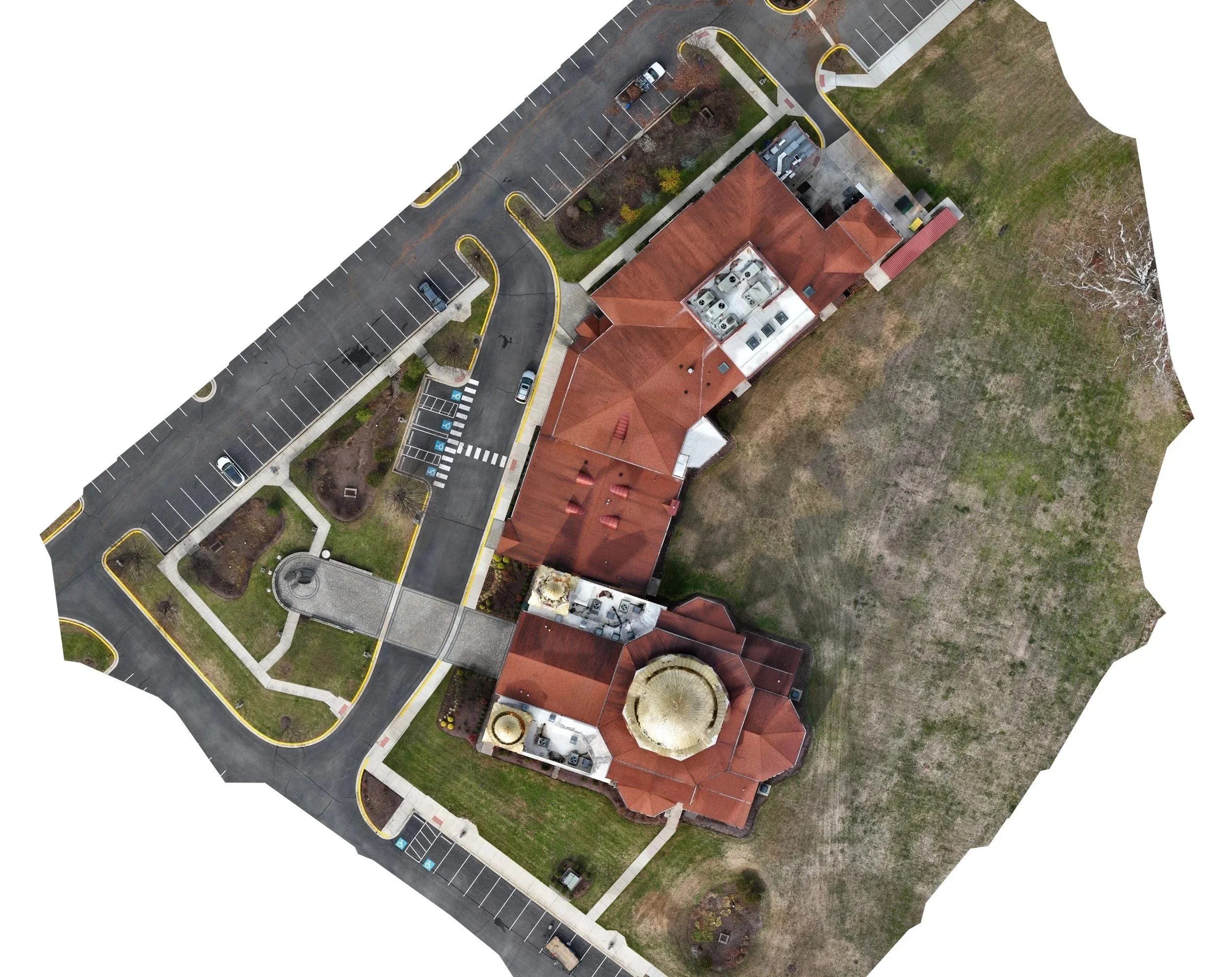
2D Orthomosaic (GeoTIFF / PDF)
Measurable aerial map aligned to real-world coordinates.
-
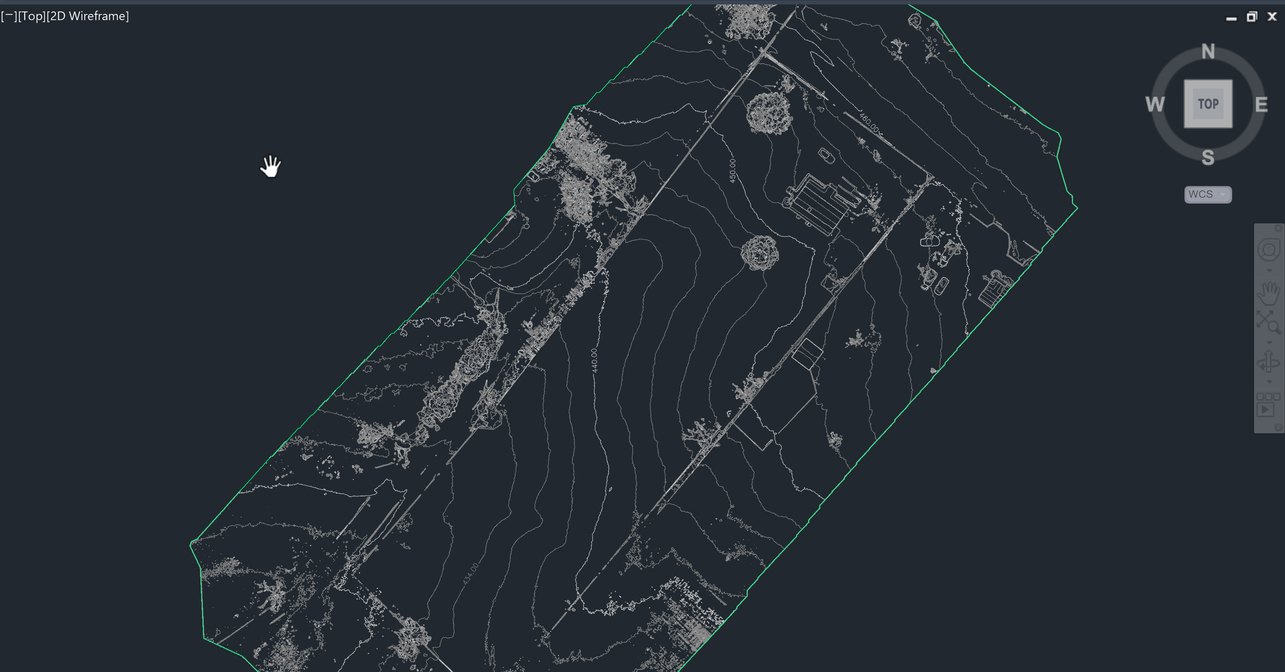
![A screenshot of a CAD software displaying a topographical map with contour lines, property boundaries, and some structures, viewed in wireframe mode on a dark background.]()
DSM / DTM Surface Models
Elevation surfaces for topo, drainage review, and planning.
-
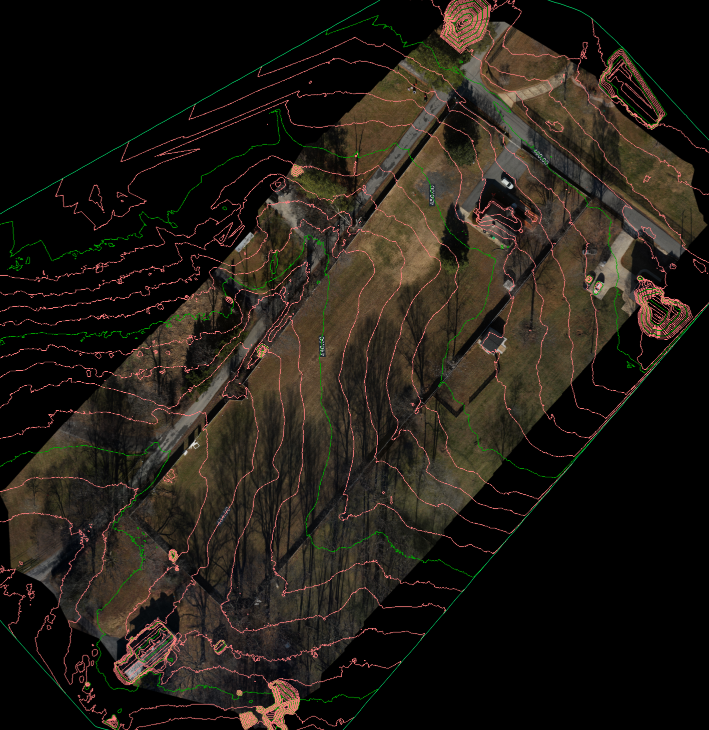
![Aerial view of houses with a landscape overlay including contour lines and elevation points.]()
Contours
Clean contours derived from DTM (bare earth) when required.
-
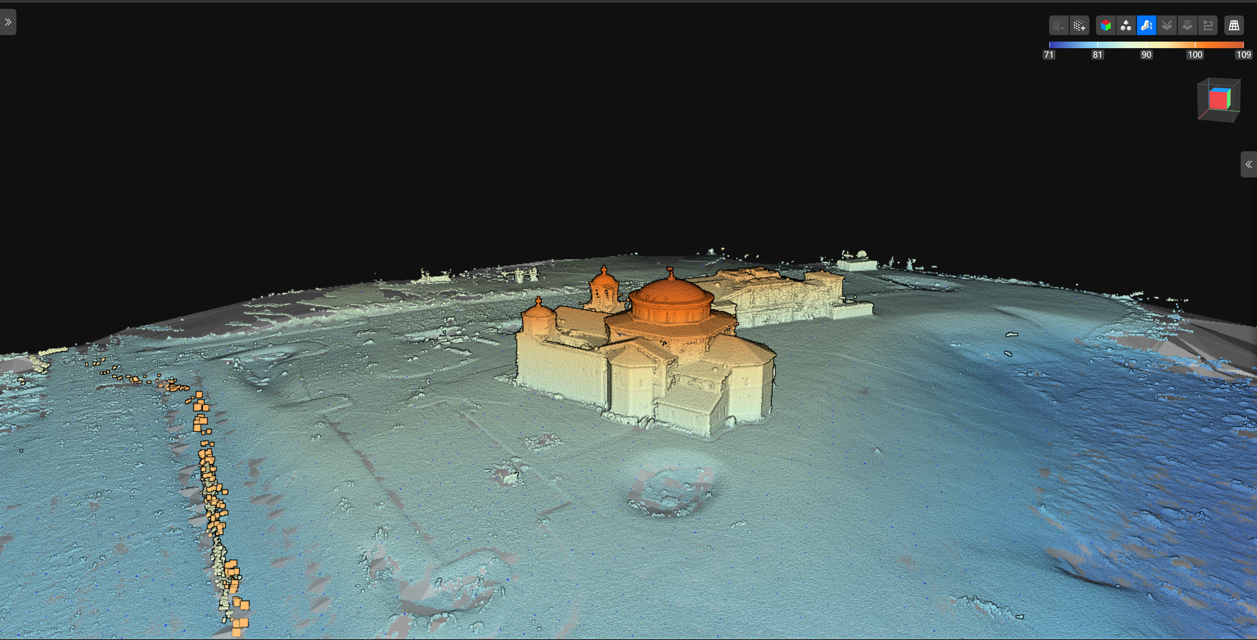
![3D laser scan of a historic building or castle on a hill, surrounded by terrain, with a dark background and color spectrum scale at the top.]()
Point Cloud (LAS/LAZ)
Dense point cloud for survey workflows and CAD/GIS use.
-
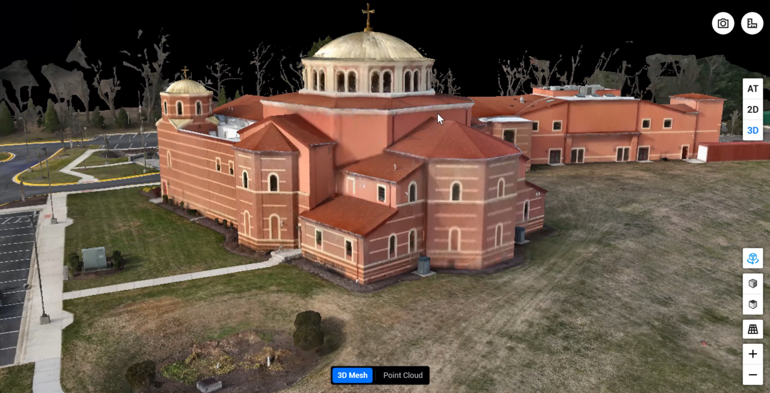
![A 3D model of a large church with red brick walls, multiple roof sections, and a prominent central dome with a cross on top, surrounded by parking lot and landscaped area.]()
3D Mesh / Textured Model
Great for visuals, site context, and stakeholder communication.
Use Cases
Construction progress & documentation
Earthwork / grading verification
Stockpile & volume tracking (monthly/weekly)
Pre-design site context
Survey support (control-based flights as needed)
As-built mapping & existing conditions
WorkFlow
Scope & deliverables (what formats + accuracy target)
Flight plan + site coordination
RTK flight + optional GCP/check points
Processing + QA/QC
Delivery + revisions
Accuracy + Control
Accuracy depends on site conditions and control. Projects can be flown using RTK and verified with Ground Control Points (GCPs)/Check Points when required. I can provide a simple accuracy summary and checkpoints on request.
Frequently Asked Questions
-
Accuracy depends on site conditions (vegetation, texture, lighting), flight altitude/GSD, and whether the project uses RTK and/or ground control. I can deliver RTK-based mapping and, when required, integrate GCPs/check points for verification and an accuracy summary.
-
Yes—when the project calls for survey-grade verification or tighter tolerances. Many construction progress and planning jobs can be done RTK-only. For survey support work, I can fly to your surveyor’s control and include check points to verify results.
-
An accuracy summary is a brief report comparing known check points (ground truth) to the mapped coordinates from the deliverable. It typically includes a check point table and summary statistics like horizontal and vertical RMSE, plus notes on site conditions.
-
I can deliver in the coordinate system you specify (commonly State Plane / NAD83 or project-specific control). If you’re unsure, I can deliver in a standard system and/or match your surveyor’s control when provided.
-
Yes—deliverables can be provided in formats that import cleanly into Civil 3D/Carlson workflows (surface grids/point data, contours, breaklines where applicable). If you have a preferred template, units, or layer naming, I can follow it.
-
Common deliverables include:
Orthomosaic: GeoTIFF, PDF
Point cloud: LAS/LAZ
Surfaces (DSM/DTM): GeoTIFF, XYZ/CSV, and CAD/GIS-compatible formats as needed
Contours / linework: SHP, DXF/DWG (project dependent)
If you tell me your software (Civil 3D, Carlson, ArcGIS/QGIS), I’ll format exports accordingly.
-
I can provide both:
DSM = top surfaces (ground + vegetation/objects)
DTM (bare earth) = filtered surface intended to represent ground
Bare-earth accuracy depends on vegetation density and data quality; heavily wooded areas may require additional methods or expectations.
-
Yes. I can compute stockpile volumes and cut/fill when you provide a baseline surface (previous scan, design surface, or existing ground). Deliveries can include a simple volume report and supporting surfaces.
-
Typical turnaround is 2–5 business days depending on acreage, deliverables, and weather/site access. Rush options may be available for smaller sites.
-
Common factors include wind, low light, reflective surfaces (water/glass/metal roofs), repetitive textures, and heavy vegetation. I plan flights to reduce these issues and run QA checks before delivery.
-
I provide mapping and geospatial deliverables for construction and survey support. Boundary determination and legal surveying services must be performed and signed by a licensed professional land surveyor (PLS). I’m happy to work under a surveyor’s direction and control when needed.